


According to the National Weather Service in Little Rock, a very unsettled weather pattern is expected today through Sunday. Severe weather and excessive rain appear likely at this time.
Today, a warm front is expected to move north across Arkansas. North of the front, showers and thunderstorms will develop mainly north of Little Rock.
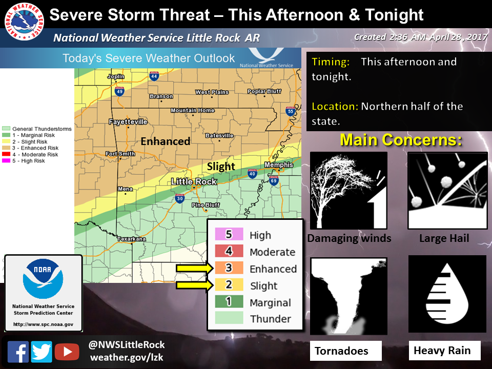
Any storms that develop along or south of the warm front this afternoon through tonight will have a chance of becoming severe. Only isolated storms are expected along or south of the front, but if storms develop here, they will be capable of producing large hail, damaging winds and tornadoes.
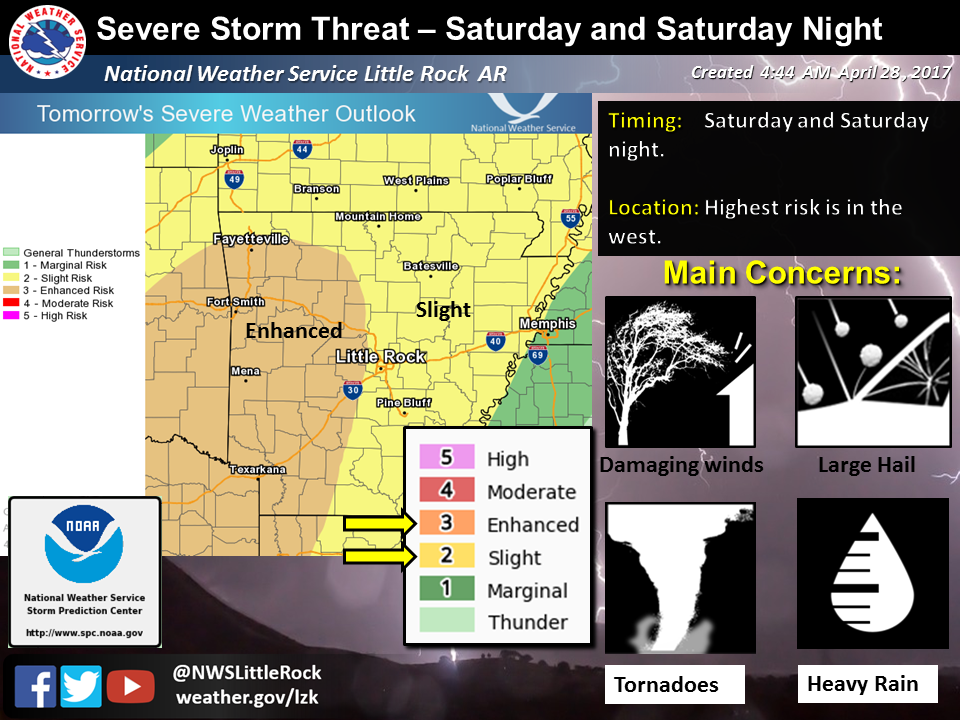
Precipitation across the northern counties will be ongoing heading into Saturday. Later in the day, a storm system in the Plains will drag a cold front toward the state. Ahead of the front, a large area of showers and thunderstorms will sweep through the region Saturday night and Sunday.
Tornadoes, damaging winds, and large hail will once again be possible with this long duration event. More than a half foot of rain could fall in the northwest half of Arkansas.
If this pans out, widespread and life threatening flash flooding would occur. Also, area tributaries would flood, including the Black, Buffalo, Cache, Eleven Point, Fourche La Fave, Petit Jean, Spring, and White Rivers.
Forecast details are still being worked out, including where the warm front will set up today, and the timing of the aforementioned bouts of precipitation. Please continue to monitor the latest forecasts from your National Weather Service concerning this potentially dangerous situation.