


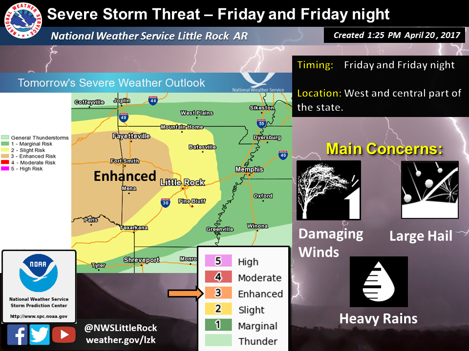
According to the National Oceanic and Atmospheric Administration (NOAA), a cold front is just entering northwest Arkansas this afternoon. The front will move slowly through the state Friday and Saturday with showers and thunderstorms. The front will exit eastern Arkansas by Saturday evening.
Saline County is in the area of slight risk during this time.
Some of the thunderstorms are expected to become severe with the main threats being damaging winds, large hail, and heavy rain… and an isolated tornado can not be ruled out. SPC has issued an Enhanced Risk for severe thunderstorms for Friday and Friday night for west, northwest and parts of central Arkansas.
Please stay informed of our latest forecasts as this potentially severe weather situation evolves.